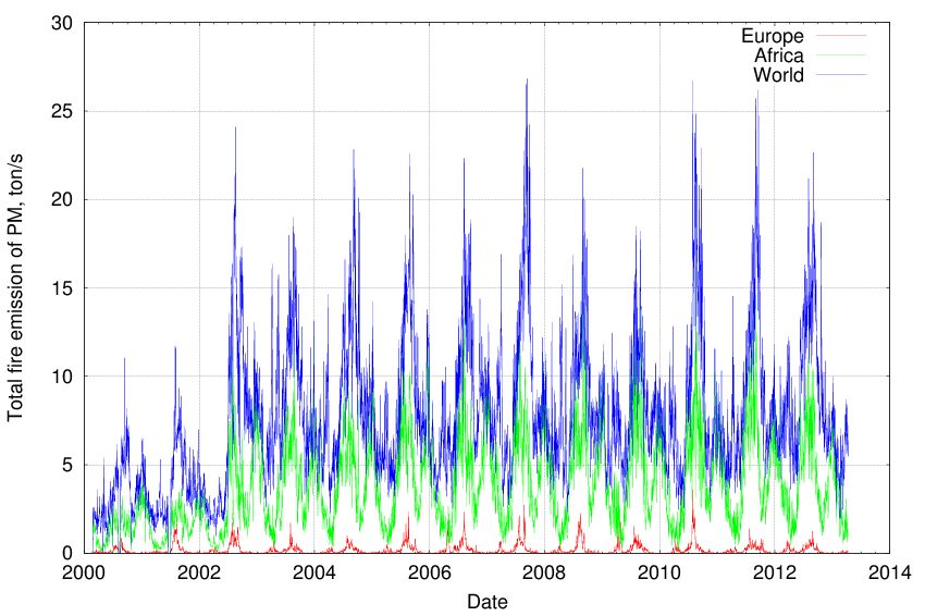
The current emission dataset has been obtained by re-analysis of fire radiative power data obtained by MODIS instrument onboard of Aqua and Terra satellites. The period covered is from February 2000 onwards (extension of the period is planned on annual basis). For the period from Feb 2000 till July 2002, only MODIS-Terra data are available, therefore the fire detection was less efficient than during the operation of both satellites.
The algorithm of the emission evaluation and comparison of the results for Europe with the GFEDv2 is presented in the IS4FIRES description.
The IS4FIRES output data are availible in native SILAM format sa2 ( described here) and in netcdf format.
The emission data are available for:Custom subsets in 0.1 x 0.1 degree spatial resolution can be accessed with several protocols from Fire emission catalog at our TREDDS server. There you can also see maps and animations (via Godiva2 interface).
The total emission rates for different datasets 2000-2013 (NOTE: 2000-2002.07 only TERRA was operational):
