The current emission dataset has been obtained by re-analysis of fire radiative power data obtained by MODIS instrument onboard of Aqua and Terra satellites, collection 6. The period covered is from March 2000 onwards with daily extension of the period. For the period from Mar 2000 till July 2002, only MODIS-Terra data are available, therefore the fire detection was less efficient than during the operation of both satellites.
The algorithm of the emission assessment and comparison of the results for Europe with the GFEDv2 is presented in the IS4FIRES v.1 description and updates made for IS4FIRES v.2.0 are discussed by Soares et al (2015) .
The IS4FIRES v.2.0 output is availible as daily (in near-real-time) and monthly (retrospectively) NetCDF4 files (150--200M each) as a part of the SILAM model archive here .
The emission data are global, 3-hourly, 0.1 x 0.1 degree spatial resolution and 5 stacked vertical layers.The SILAM archive also contains the fire smoke dispersion forecasts globally at 0.1 x 0.1 degree as images and as NetCDF4 data files .
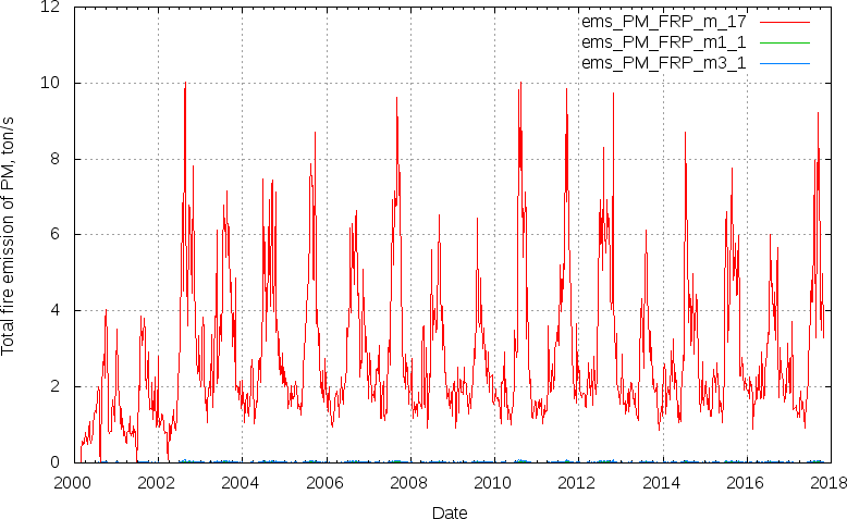
The total emission rates for the globe 2000-2018 (NOTE: 2000-2002.07 only TERRA was operational):